|
|
||||
|
|
||||
|
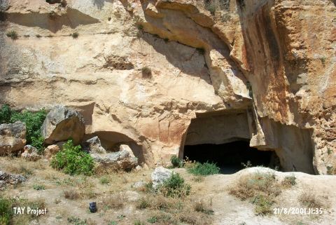
Biçme Magarasi |
||||
|
For cave maps and drawings please click on the picture... |
For photographs please click on the photo... |
|||
|
 |
|||
|
Type: |
Cave | |||
|
Altitude: |
930 m | |||
|
Depth: |
m | |||
|
Length: |
m | |||
|
Region: |
Southeastern Anatolia | |||
|
Province: |
Gaziantep | |||
|
District: |
Merkez | |||
|
Village: |
Dülük | |||
|
|
||||
 |
||||

| It is located in the Dülük Village; 11 km north of the Gaziantep provincial centre. It was first found and excavated by E.Y. Bostanci. It is not reported to which period the potsherds; uncovered in upper layer together with the stone tools dating to the Palaeolithic Age; belong to. |
| Location: This cave site lies in the village of Dülük; 11 km north of the city of Gaziantep. |
| Structural Properties and formation : |
| Research History: |
| Findings: |