|
|
||||
|
|
||||
|
Beldibi / Kumbucagi |
||||
|
For cave maps and drawings please click on the picture... |
For photographs please click on the photo... |
|||
|
 |
|||
|
Type: |
Rock Shelter | |||
|
Altitude: |
30 m | |||
|
Depth: |
m | |||
|
Length: |
m | |||
|
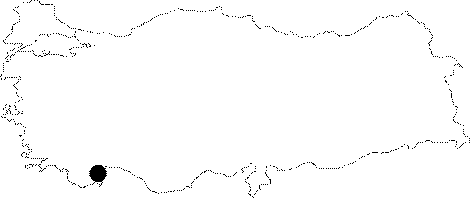
Region: |
Mediterranean | |||
|
Province: |
Antalya | |||
|
District: |
Kemer | |||
|
Village: |
Beldibi | |||
|
|
||||
 |
||||
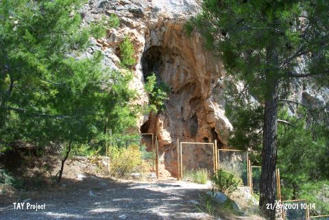
| Location: This rock shelter site is 24 km southwest of the city of Antalya; 3 km north of the village of Beldibi; a village 800 m inland from the shore. It lies at the northern point of a long and thin beach; on a limestone outcrop by the sea; approximately 100 m from the shore. The shelter; which today is hidden by the forest vegetation around it; is difficult to find. The Antalya-Kemer highway is very close to the site. It is possible to reach the rock-shelter by walking down from this highway. |
| Structural Properties and formation : Having a 1.2 m thick fill soil; it is hardly accessible. Under the cave; there is a rock shelter with a 3 m long exposure; but a depth not exceeding a few meters; where it extends onto the sea like a semi-circle terrace. |
| Research History: It was discovered by E.Y. Bostanci in 1956 and started to be excavated in 1959 [Bostanci 1959:145]. Bostanci reports that the excavation was continued in 1960; 1966 and 1967; and a depth of 6 meters was reached. |
| Findings: The rock shelter under the cave have been excavated. During the excavations; eight layers; the first three being two-phased; and seven confirmed and one suspicious; have been revealed. |