|
|
||||
|
|
||||
|
Yarimburgaz Magarasi |
||||
|
For cave maps and drawings please click on the picture... |
For photographs please click on the photo... |
|||
|
 |
|||
|
Type: |
Cave | |||
|
Altitude: |
20 m | |||
|
Depth: |
m | |||
|
Length: |
1021 m | |||
|
Region: |
Marmara | |||
|
Province: |
Istanbul | |||
|
District: |
Küçükçekmece | |||
|
Village: |
Altinsehir | |||
|
|
||||
 |
||||
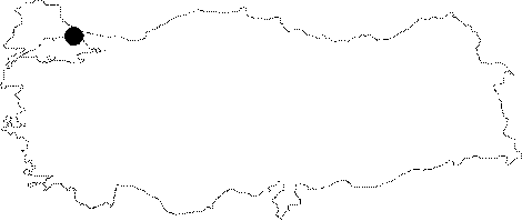
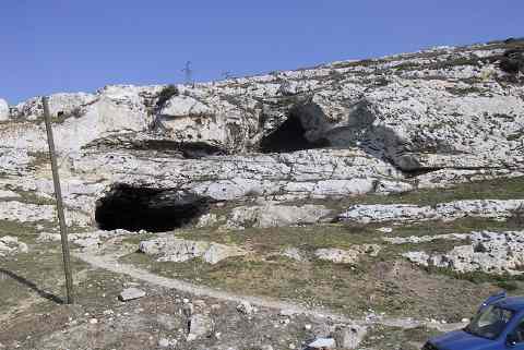
| Location: This double mouthed cave lies approximately 22 km northwest of the city of Istanbul in the district of Küçük Çekmece; about 1.5 km north of the northern shore of the Küçük Çekmece Lake. It is 1 km north of the shantytown of Altinsehir (now a district of Istanbul); northeast of the road from the village of Samlar; which is north of Altinsehir; to Kayabasi; on the east bank of the Sazlidere (Azatli) River which empties into the Küçük Çekmece Lake. Because the cave has two mouths; the site is also referred to in the plural as the Yarimburgaz Caves. |
| Structural Properties and formation : Opened through abrasion of the underground waters on the western slope; facing Sazlidere; over a Eocene origin calcareous formation; it consists of two interconnected sections with diverse forms and dimensions as well as diverse entrances at different levels. It is nearly 11-18 m high from the Marmara Sea. Of these two sections roughly elongating in the northeast-southeast direction; the upper one (Upper Cave/Gallery B) is like a large hall (cavity) with a dimension of about 15x52 m and a present height of 10 m. It was; probably; used as a church during Byzantine Period after some adjustments. The holes on the walls for bond courses indicate that there used to be a setback storey with a tiled roof. It is certain that this church is related with the monastery building outside the cave. The lower part (Lower Cave/Gallery A); which initiates like a gallery; then continuing like a tunnel toward the deepness of the rocks; meandering; and composing some large halls is accessed from the upper level through a ramp near the entrance. Although the upper cave is occluded immediately; the lower one continues about 600 m. Following the bifurcation approximately 240 m after the entrance in the lower cave; the right branch elongates a little more than the left branch; becoming so narrow that it does not allow any further progress after a somewhat wide vestibule at the end. The formation marks of the cave can be traced by the presence of an eastward valley steep to Sazlidere. It is likely that this sedimented valley was an elongation of the lower cave during the Lower Palaeolithic Age. During the excavations; the bedrock was reached only at the entrance in the lower cave; and the actual height of the cave was not determined since it couldn't have been descended. It is estimated that the environmental conditions during the Palaeolithic Age were very different than present. |
| Research History: The first significant excavations at Yarimburgaz; which was first introduced to the scientific world by Abdullah Bey in the mid 19th century were carried out in 1963 under the supervision of Kilic Kökten; followed by a systematic excavation including arrangement in squares in 1964 and 1965 under the supervision of Kansu; Kökten and N. Dolunay. Due to heavy damage by various causes from 1966 to 1986; the second phase of Yarimburgaz excavations was carried out in 1986 under the leadership of Mehmet Ozdogan; a professor from the Department of Prehistory; Faculty of Letters; Istanbul University. As a result of this rescue excavation; it was found that the oldest settlement was dated back to the Lower Palaeolithic Age. The third phase of the excavations was conducted as a joint project by two universities in 1988-1990 under the supervision of Güven Arsebük; a professor from Department of Prehistory; Faculty of Letters; Istanbul University by the participation of F. Clark Howell; a professor from Department of Anthropology of California University; Berkeley; USA. It was explored and mapped by BUMAK in 1984-85; and mapped to the BCRA 5d standards. Later on; it was biospeleologically explored under the Eurasian Bridge '99 Project. |
| Findings: A few number of bats (R. ferrumequinum; R. hipposideros; R. euryale and M. schreibersii; Myotis myotis; Miniopterus schreibersii) was seen. It was included among the First Degree Archaeological-Natural Sites in 2001. |