|
|
||||
|
|
||||
|
Magaracik E Magarasi |
||||
|
For cave maps and drawings please click on the picture... |
For photographs please click on the photo... |
|||
|
 |
|||
|
Type: |
Cave | |||
|
Altitude: |
m | |||
|
Depth: |
m | |||
|
Length: |
23 m | |||
|
Region: |
Eastern Anatolia | |||
|
Province: |
Kars | |||
|
District: |
Merkez | |||
|
Village: |
Magaracik | |||
|
|
||||
 |
||||
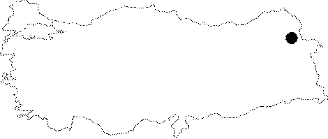
| It lies in the Borluk Valley where the Magaracik Village is located; 17 km Southeast of Kars. K. Kökten who conducted surveys in Borluk Valley in 1942 reported that there are many rock shelters and caves in the vicinity of the Magaracik Village. He made excavations in one of these caves; which he defined as Cave E on the front bench and internal floor; and informed that he uncovered findings from the Chalcolithic Age; and obsidian had been used in the Palaeolithic stone industry among these findings without providing further information. |
| Location: |
| Structural Properties and formation : |
| Research History: |
| Findings: |