|
|
||||
|
|
||||
|
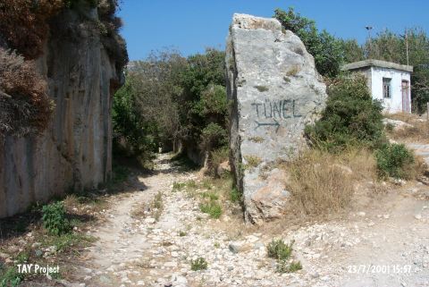
Kanal Magarasi |
||||
|
For cave maps and drawings please click on the picture... |
For photographs please click on the photo... |
|||
|
 |
|||
|
Type: |
Cave | |||
|
Altitude: |
30 m | |||
|
Depth: |
m | |||
|
Length: |
m | |||
|
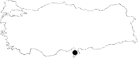
Region: |
Mediterranean | |||
|
Province: |
Hatay | |||
|
District: |
Samandag | |||
|
Village: |
Magaracik | |||
|
|
||||
 |
||||
| Location: This cave site is southwest of the city of Antakya; northwest of the town of Samandag and very close to the village of Magaracik; on the cliffs of Mount Musa. It is approximately 500 m from the Merdivenli Cave; by the Roman water canals and lies 300 m from the Mediterranean; facing the sea. The entrance of the cave is 20 meters above sea-level. If one stands facing the cliffs from where the Roman canals reach the sea; the mouth of the cave can be spotted on the left while the base will be on the right. |
| Structural Properties and formation : Even included in the 1:100.000 scale map; it was opened within the Helvetian limestones. It was partly rescued from the damage of the water channel opened by the inhabitants of Selevkia; a Roman city to save their port from filling up. No information is available about its dimensions; only it is known that the entrance is small and triangle-like. It was called Kanal Cave by E.Y. Bostanci as the mid-part was destroyed by the channel. Now; it doesn't look like a cave because of the damage. |
| Research History: It was first found in 1966; and excavated in 1966; 1967 and 1969 which were all led by E.Y. Bostanci. The excavation was carried out in the front and open section of the cave. It was mapped by Ozbek to the 2b standard. |
| Findings: The surface collection made when the first trench was opened revealed a Aurignacien culture from the Upper Palaeolithic Age in the entrance zone. And; continued excavations displayed the presence of a Middle Palaeolithic settlement by the underlying flake tools carrying the characteristics of the Middle Palaeolithic Age. |