|
|
||||
|
|
||||
|
Kagilcik Magarasi |
||||
|
For cave maps and drawings please click on the picture... |
For photographs please click on the photo... |
|||
|
 |
|||
|
Type: |
Cave | |||
|
Altitude: |
1290 m | |||
|
Depth: |
m | |||
|
Length: |
m | |||
|
Region: |
Mediterranean | |||
|
Province: |
Burdur | |||
|
District: |
Karamanli | |||
|
Village: |
Kagilcik | |||
|
|
||||
 |
||||

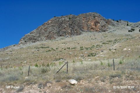
| It is located on a rocky mass called Kagilcik Mountain to the north of the Tefenni Plain; east of the Karaman District; Southwest of Burdur. It was found by J. Birmingham in 1964. Potsherds from the dark faced burnished ware were uncovered. |
| Location: |
| Structural Properties and formation : |
| Research History: |
| Findings: |