|
|
||||
|
|
||||
|
Kes Dagi Yaylasi / Karadas Düdeni |
||||
|
For cave maps and drawings please click on the picture... |
For photographs please click on the photo... |
|||
|
 |
|||
|
Type: |
Cave | |||
|
Altitude: |
m | |||
|
Depth: |
-300 m | |||
|
Length: |
554 m | |||
|
Region: |
Mediterranean | |||
|
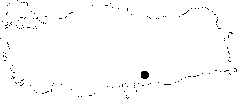
Province: |
Kahramanmaras | |||
|
District: |
Merkez | |||
|
Village: |
Döngel | |||
|
|
||||
 |
||||
| It is situated in platue of the Mount Kes in Dongel Village, in central Kahramanmaraş. Water resource of the cave is not limited with the platue, by going through deeper levels large and bulky branches from adjacent basins incorporate a plenty of water into the cave. In cave having large halls, galleries, high ceilings and intensive metamorphic rock, there exists a huge descent encountered after a depth of 175 m [Obruk 2010: 11]. From this level water flows through fault and the formations change radically. Even if the team surveyed till the depth of 300 m, they would not reach to the base [Obruk 2010: 34-35]. |
| Location: |
| Structural Properties and formation : |
| Research History: |
| Findings: |