|
|
||||
|
|
||||
|
Kayaönü |
||||
|
For cave maps and drawings please click on the picture... |
For photographs please click on the photo... |
|||
|
 |
|||
|
Type: |
Cave | |||
|
Altitude: |
1333 m | |||
|
Depth: |
1 m | |||
|
Length: |
42 m | |||
|
Region: |
Central Anatolia | |||
|
Province: |
Karaman | |||
|
District: |
Ermenek | |||
|
Village: |
Kayaönü | |||
|
|
||||
 |
||||
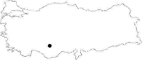
| Kayaonu Cave lies on the north slope of Ermenek Stream deeply cutting the region. Cave laying 12 km east of Ermenek is accessible through Kayaonu Village after Cetince Village on the road of Ermenek - Mut. It is a fossil and horizontal cave aged limestone belonging to Miocene. Cave with 42 m of length ans 1 m of maximum attitude over entrance attitude is covered with blocks, rubble and soil. Cave with low ceiling (0.5-2 m) has a hot (18-20 degree) and a dry (50-60) weather. |
| Location: |
| Structural Properties and formation : |
| Research History: |
| Findings: |