|
|
||||
|
|
||||
|
Bolay Düdeni |
||||
|
For cave maps and drawings please click on the picture... |
For photographs please click on the photo... |
|||
|
 |
|||
|
Type: |
Cave | |||
|
Altitude: |
m | |||
|
Depth: |
-46 m | |||
|
Length: |
159 m | |||
|
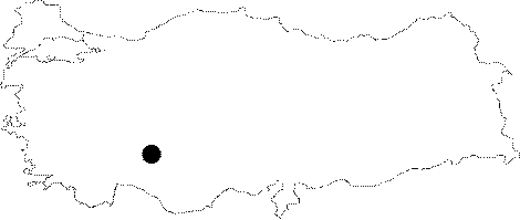
Region: |
Central Anatolia | |||
|
Province: |
Konya | |||
|
District: |
Taskent | |||
|
Village: |
Bolay | |||
|
|
||||
 |
||||
| Surveyed and mapped by MAD in July 2005 [MAD 14:55]. |
| Location: |
| Structural Properties and formation : |
| Research History: |
| Findings: |