|
|
||||
|
|
||||
|
Yesillik |
||||
|
For cave maps and drawings please click on the picture... |
For photographs please click on the photo... |
|||
|
 |
|||
|
Type: |
Horizontal Cave | |||
|
Altitude: |
480 m | |||
|
Depth: |
-13 m | |||
|
Length: |
135 m | |||
|
Region: |
Marmara | |||
|
Province: |
Kirklareli | |||
|
District: |
Demirköy | |||
|
Village: |
Armagan | |||
|
|
||||
 |
||||
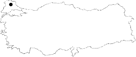
| Yeşillik Cave is located in a forested region on the northern side of Armağan Village. The Cave is formed inside limestone layers in Mesozoic metamorphic and intrusive rocks of Strandja Massif. Yeşillik Cave is a fossil cave with four small chambers. The base of the first chamber from the entrance is covered with depression rocks. Other chambers' bases are covered with mud and guano. The cave has a weak variety of flowstone formations. The depth of the cave is 13 m and its total length is 135 m. |
| Location: |
| Structural Properties and formation : |
| Research History: |
| Findings: |