|
|
||||
|
|
||||
|
Tepebasi |
||||
|
For cave maps and drawings please click on the picture... |
For photographs please click on the photo... |
|||
|
 |
|||
|
Type: |
Cave | |||
|
Altitude: |
m | |||
|
Depth: |
-11 m | |||
|
Length: |
30 m | |||
|
Region: |
Mediterranean | |||
|
Province: |
Burdur | |||
|
District: |
Bucak | |||
|
Village: |
||||
|
|
||||
 |
||||
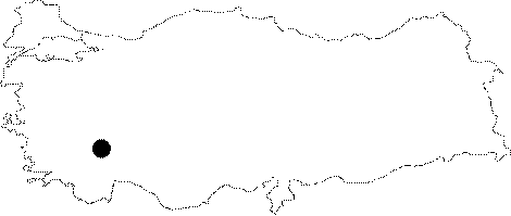
| Location: It is located on top of a hill to the southeast of the Bucak District. The entrance is 200-250 m high from the valley. |
| Structural Properties and formation : It is entered through a 5 m long narrow hole; which then enlarges and divides into two branches. The branch on the left is occluded with stones. The right branch continues for a while and gets narrower. |
| Research History: It was explored by AMAG in 1992. |
| Findings: |