|
|
||||
|
|
||||
 |
Sütini |
|||
|
For cave maps and drawings please click on the picture... |
For photographs please click on the photo... |
|||
|
 |
|||
|
Type: |
Horizontal Cave | |||
|
Altitude: |
210 m | |||
|
Depth: |
-32 m | |||
|
Length: |
340 m | |||
|
Region: |
Aegean | |||
|
Province: |
Izmir | |||
|
District: |
Selçuk | |||
|
Village: |
Degirmen | |||
|
|
||||
  |
||||
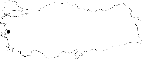
| Location: It is located 1 km north of the motorway running from Selcuk to Sirince; with an altitude of about 80 m. |
| Structural Properties and formation : It has two entrances; close to each other. Remains of fresco and daub are observed in the small room across the upper entrance. A 4;5 m high chimney can be reached crawling through this room; of which the roof gradually narrows. Following that; a 8;5 m descent leads into a hall. It can also be reached by crawling from the lower entrance. The hall contains wall inscriptions as well; like in many other parts of the cave. It is a fossil cave in the collapsing phase. |
| Research History: It was explored by BUMAK in 1986; and traversed up to 180 m; and mapped to the 5c standards. |
| Findings: Photographs of the inscriptions on the wall were taken; and examined by S. Ogüt of the Istanbul Archaeological Museum and B. Aksoy of the Bogazici University; and it was concluded that they are graffiti (specific names) in archaic characters. On the other hand; based on the potsherds and inscriptions; Atalay indicated that the cave had been inhabited by the Byzantines during the 14th century [Cokdeger 1993:8-9]. The first 15 m of the cave is covered with a colony of small fruit flies. Millipedes; bats; and cave grasshoppers were seen in other sections [Güldali et al. 1985:6-11]. |

