|
|
||||
|
|
||||
|
Sögütlü |
||||
|
For cave maps and drawings please click on the picture... |
For photographs please click on the photo... |
|||
|
 |
|||
|
Type: |
Cave | |||
|
Altitude: |
42 m | |||
|
Depth: |
22 m | |||
|
Length: |
470 m | |||
|
Region: |
Marmara | |||
|
Province: |
Sakarya | |||
|
District: |
Sögütlü | |||
|
Village: |
Magara | |||
|
|
||||
 |
||||
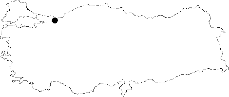
| Location: It is located near the Magara Village on the shore of Sakarya River 12 km east of the Sögütlü District 13 km northeast of Adapazari. |
| Structural Properties and formation : It is the longest cave of the region. The Sögütlü Cave which is on the western side of the last channel (Magara Channel) formed by the Sakarya River before it empties in the sea; is on a clear fault in east-west direction. Sögütlü which had developed horizontally; and consists of four clear development stories; extends circa in east west direction. The last two sections splits into two branches. The last part of one of those branches is at +22 mm from the entrance; and +22.5 m in the other. The cave width is 1-8 m; the height is 1.5-20 m. The cave has a narrow entrance blocked by sand and pebbles; which overlooks the northeast direction. The alluvial block that causes a pond formation of 25 m in length; and 1-1.5 m in depth in its background; was excavated later; and lowered to a height to facilitate the passage of people. There is a 4 m high dripstone bridge at the end of this section. The cave continues after the bridge. On the other hand there is another gallery underneath the bridge. The cave main gallery starts after the dripstone bridge. This section which consists of numerous adjacent dripstone ponds; bears the highest ceiling of the cave (up to 20 m height). There is an eliptic ceiling and accumulation terraces underneath that ceiling underneath this section. The accumulation terraces that reach 2 m width; consisting of sand; pebble; and debris; were expanded in two different elevations. The basin of the Havuzlu Galeri where the stalactites; and bacon rinds form on the ceiling and side walls; is filled with stalagmites; and dripstone ponds. The Havuzlu Galeri with the high ceiling splits in two sections after the last pond. The section that is 3 m above the main gallery basin that developed in south-southeast direction is the suspended Fosil Galeri. The last section of the Fosil Galeri is at 420 m from from the entrance; and filled with rich dripstone formations inside. On the other hand the main gallery that continues west or southwestbound goes through a clear structural and developmental change in the shape. The section covered with humongous blocks had developed inside the black and green limestones. Çöküntü Galerisi splits in two branches in the end. Among those; Aktif Güney Galerisi extends as an extension to the main gallery; and ends with a closed siphon. The last point of this gallery is at +22 m from the entrance; and the basin is covered with sand and pebble piles. On the other hand the branch extending northbound is narrower. This northbound; half active Kuzey Galerisi bears a small subsurface stream and the last point is at +22.5 m from the entrance. |
| Research History: It was researched by the Geological Studies Department of the MTA General Directorate and published in 2002. |
| Findings: There are a few bats living in some parts of the high ceiling Havuzlu Galeri. |