|
|
||||
|
|
||||
|
Seferdeligi |
||||
|
For cave maps and drawings please click on the picture... |
For photographs please click on the photo... |
|||
|
 |
|||
|
Type: |
Horizontal Cave | |||
|
Altitude: |
100 m | |||
|
Depth: |
+2;-20 m | |||
|
Length: |
257 m | |||
|
Region: |
Mediterranean | |||
|
Province: |
Burdur | |||
|
District: |
Bucak | |||
|
Village: |
Merkez | |||
|
|
||||
 |
||||
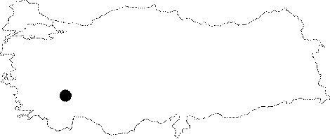
| Location: It lies to the north of the Incirhan Mevkii of the Bucak District. |
| Structural Properties and formation : It elongates like two corridors on eastern and western wings from the entrance. There are two big halls on the right and left sides; which are very rich in decorations. |
| Research History: It was explored and mapped by AMAG in 1992; followed by S. Niggemann and his team in the same year. |
| Findings: Big colonies of bats and guano deposits were seen in the halls. |