|
|
||||
|
|
||||
|
Postavurdugu |
||||
|
For cave maps and drawings please click on the picture... |
For photographs please click on the photo... |
|||
|
 |
|||
|
Type: |
Horizontal Cave | |||
|
Altitude: |
275 m | |||
|
Depth: |
-4 m | |||
|
Length: |
47 m | |||
|
Region: |
Marmara | |||
|
Province: |
Bursa | |||
|
District: |
Iznik | |||
|
Village: |
Boyalica | |||
|
|
||||
 |
||||
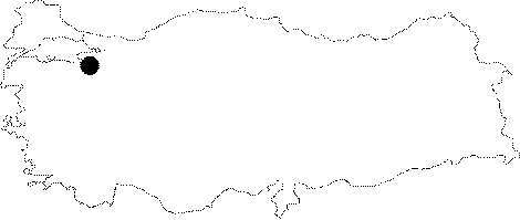
| Location: It lies on the shore of the Iznik Lake over the Ballikaya Hill; 3 km east of Boyalica Town; 20 km northwest of Iznik. The Iznik-Boyalica-Karamürsel motorway runs to the immediate south of the cave. |
| Structural Properties and formation : It was formed within the Permian schists or overlaying marble block. It is spring type of cave which halted its development. Consisting of a single hall; it has two shaft-like entrances. The floor is covered by blocks; debris and a thick soil layer. There are some dripstone decorations in the narrow gallery on the northern section. It is dry in all seasons. |
| Research History: It was explored and mapped by MTA; and published in 1997. |
| Findings: Bones; probably of an elephant or rhino; were uncovered in the soil layer at the bottom. |