|
|
||||
|
|
||||
|
Peynirlikönü Düdeni |
||||
|
For cave maps and drawings please click on the picture... |
For photographs please click on the photo... |
|||
|
 |
|||
|
Type: |
Vertical Cave | |||
|
Altitude: |
1900 m | |||
|
Depth: |
-1429 m | |||
|
Length: |
3118 m | |||
|
Region: |
Mediterranean | |||
|
Province: |
Mersin | |||
|
District: |
Anamur | |||
|
Village: |
Sugözü | |||
|
|
||||
 |
||||
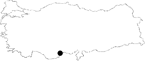
| Location: It lies on the Cukurpinar Upland of the Taseli Plateau of the Anamur District of Icel. The entrance is 1900 m high from the sea level. The basin consists of the Cukurpinar Sinkhole and the Peynirlik Upland; which deviates from the Cukurpinar Upland where the camping site is located; by a ridge. |
| Structural Properties and formation : When it was discovered by BUMAK; it was suggested that it was almost impossible to move farther because of the largeness of the basin and narrowness of the entrance. The roof disappears following the first very narrow part of 100 m. Majority of the cave is formed by 1 m wide galleries with high roofs; and water at bottom. Down to -1300 m; there are a few flat areas where it is possible to walk only for a short distance. Two of these areas have been already occupied as camping ground. Catwalks: The catwalks comprising the entrance zone of the cave are connected to a section which requires crawling. After this section ends and becomes somewhat larger; the cave takes the form of a tunnel; which becomes narrower and continues by curling half a meter in diameter. This section continues like that until a 20 m long descent. From -400 m to the Flower Garden Camp: It has a narrow and wet characteristics following the catwalks. The "Beauty Hall" at -65 m is the only part of the cave adorned with decorations. It becomes wider after some ups and downs at -232 m called "Sahte Huzur (False Tranquility)". Below the emergency camp at -250 m lies the Hani Tipa (Where is the Plug) Lake; the largest one found in the sections explored. Following the descent into the lake by deflection bolts; descents of 8-10 m continue until a 40 m long descent prior to the camp at -400 m. Between Flower Garden Camp (-400 meters) and Another Life Camp (-672 meters): It becomes dryer after the Flower Garden Camp. Rigging remains above the water channel. From this point up to -600 meters cave continues with few relatively long drops. Then; down to -672 meters; starts narrow passages called "Nesrin Topkapi" (a famous Turkish belly dancer) and meanders called "Allow Me Pass". Passing those narrow; screwing galleries with caving bags are really troublesome. After new descents; large fossil gallery and "Another Life Camp"; also called "700 Camp" is reached. Floor of the gallery is covered with fallen rocks; which makes camping rather difficult. Water passage is very narrow at that point; so with another descent after the fossil gallery; underground stream can been reached again. Between -672 and -1300 meters: By the active gallery; continuation of Nesrin Topkapi meanders begin again; but longer and more tiresome this time. At the end of these catwalks; there comes the longest known drop of the cave which is called "Ihlamur Agaclari Inisi" (Lime Tree Descent). After that descent; amount of water in the main gallery increases due to various small active branches. |
| Research History: The EGMA (E. Günay Ğ M. Ali Özel) Sinkhole or Peynirlikönü Sinkhole as local people call it; was found by BUMAK team who were exploring the Cukurpinar Sinkhole in 1990. It was explored to a depth of -65 m one year after it was found. After the bottom of Cukurpinar Sinkhole (-1196 m) was reached in 1992; more attention and efforts were spent for the Peynirlikönü Sinkhole. It reached to -232 meters in 1992; -530 meters in 1994; -700 meters in 1995; -1040 meters in 1996 and finally; -1377 meters in 1997; resulting to be the deepest cave of Turkey. In 1998; the camp was discontinued at -672 m due to a series of unfortunate events. In 2000; the cave was rigged down to -672 m for the novice members of BUMAK to exercise the techniques for the excursion planned for next year. In 2001; the cave was flooded due to heavy rain; and the exploration was discontinued at -1300 m following the death of Mehmet Ali Ozel. It was completely traversed in 2004 by cooperation of the Bulgarian Caving Federation and BUMAK and listed in the literature as the deepest cave in Turkey with -1429 m. |
| Findings: |