|
|
||||
|
|
||||
|
Nalkirantepe |
||||
|
For cave maps and drawings please click on the picture... |
For photographs please click on the photo... |
|||
|
 |
|||
|
Type: |
Vertical Cave | |||
|
Altitude: |
50 m | |||
|
Depth: |
-33 m | |||
|
Length: |
42 m | |||
|
Region: |
Aegean | |||
|
Province: |
Aydin | |||
|
District: |
Kusadasi | |||
|
Village: |
Merkez | |||
|
|
||||
 |
||||
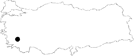
| It can be reached by a 5 minute walk to the slope of the Nalkiran Hill before reaching to the Kustur Holiday Village at the 3rd km of the Kusadasi-Selcuk motorway. It drops into a shaft. It is a dry cave. Cave grasshoppers were seen. It was explored and mapped by MTA. |
| Location: |
| Structural Properties and formation : |
| Research History: |
| Findings: |