|
|
||||
|
|
||||
|
Mazmili Düdeni |
||||
|
For cave maps and drawings please click on the picture... |
For photographs please click on the photo... |
|||
|
 |
|||
|
Type: |
Horizontal Cave | |||
|
Altitude: |
1800 m | |||
|
Depth: |
-26 m | |||
|
Length: |
65 m | |||
|
Region: |
Mediterranean | |||
|
Province: |
Adana | |||
|
District: |
Pozanti | |||
|
Village: |
Dagdibi | |||
|
|
||||
 |
||||
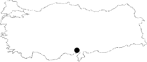
| It is located in Mazmili near the Karanfil Mountain. It has an active water inflow; a mouth formed by collapsed rocks and a northerly entrance on the dolomitic rocks facing the Karanfil Mountain. It was explored and mapped by MAD in 1989. |
| Location: |
| Structural Properties and formation : |
| Research History: |
| Findings: |