|
|
||||
|
|
||||
|
Kurudere |
||||
|
For cave maps and drawings please click on the picture... |
For photographs please click on the photo... |
|||
|
 |
|||
|
Type: |
Horizontal Cave | |||
|
Altitude: |
125 m | |||
|
Depth: |
+7 m | |||
|
Length: |
70 m | |||
|
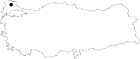
Region: |
Marmara | |||
|
Province: |
Kirklareli | |||
|
District: |
Vize | |||
|
Village: |
Hamidiye | |||
|
|
||||
 |
||||
| Location: It lies on the left upper bank of Kurudere; an important branch of Kazandere to the south of the Vize-Kiyiköy road. 300-400 m far from the road; it can be reached by walking through the pathway among oaks. The alternative name is "Cagil". |
| Structural Properties and formation : Formed depending on the abrasive surface of the Pliocene relief system; it is a fossil cave which halted its development. It has a thick fossil soil and a meandering structure; and it is adorned with wall dripstones and columns in the final zone; which is at +7.5 m in respect to the entrance. |
| Research History: It was explored and mapped by MTA. |
| Findings: No remarkable forms of life were seen. However; cave spiders and cave butterflies inhabit the entrance zone. |