|
|
||||
|
|
||||
|
Kocapinar |
||||
|
For cave maps and drawings please click on the picture... |
For photographs please click on the photo... |
|||
|
 |
|||
|
Type: |
Horizontal Cave | |||
|
Altitude: |
515 m | |||
|
Depth: |
-16 m | |||
|
Length: |
20 m | |||
|
Region: |
Marmara | |||
|
Province: |
Balikesir | |||
|
District: |
Balya | |||
|
Village: |
Kocapinar | |||
|
|
||||
 |
||||
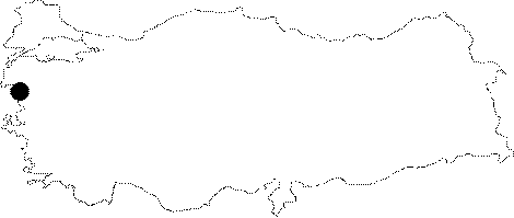
| Location: It lies 3 km north of the Kocapinar Village; 15-20 km far from Gönen to the northwest of Balikesir. |
| Structural Properties and formation : It is located at the base of a Paleo-doline; 25 m high from the valley base of the Karapinar Creek. The doline was abandoned; being breached by the creek. With water flowing into the cave during rainy times; it is a semi-active sinkhole. |
| Research History: It was explored and mapped by MTA; and published in 1997. |
| Findings: |