|
|
||||
|
|
||||
|
Kocain / Indagi |
||||
|
For cave maps and drawings please click on the picture... |
For photographs please click on the photo... |
|||
|
 |
|||
|
Type: |
Horizontal Cave | |||
|
Altitude: |
1171 m | |||
|
Depth: |
-74 m | |||
|
Length: |
633 m | |||
|
Region: |
Mediterranean | |||
|
Province: |
Antalya | |||
|
District: |
Merkez | |||
|
Village: |
Ahirtas | |||
|
|
||||
 |
||||
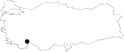
| Location: It is close to the Ahirtas Village; 45 km north of Antalya. It is accessible through the Antalya-Burdur motorway and Camilköy-Ahirtas villages. It is located on the Indagi with an altitude of 1171 m. A road leads near to the cave. |
| Structural Properties and formation : It is within the Cretaceous limestones; and a major part is fossil. As evoked by its name (Big Cave); it was formed as a result of a very big depression inside the mountain. It has the largest single-piece gallery (nearly 36.000 square meters) and the largest cave opening in Turkey. It consists of two very big halls; and the width of the entrance mouth is 70 m. Inside; there are 50-60 m high columns. |
| Research History: It was first explored by G. Moretti in 1919. The Italian archaeologists; who were invited for explorations after the occupation of Antalya and its vicinity by the Italian government based on the Armistice of Mudros; conducted comprehensive surveys in the entire region; evaluating all notifications. During these surveys which contributed to the discovery of many ancient settlements until 1921; the year the occupation was ended; Moretti and his team explored the Kocain cave; which has inscriptions; upon notification of a villager. The map which was drawn by Moretti is the oldest cave map drawn in Anatolia. The most comprehensive survey of the Kocain Cave was carried out by the cavers of the Speleo Club de Paris in 1977 and 1978. C. Chabert; who was the president of the club during that period; and drew the second map of the Kocain cave in 1978 indicated that the surveys lasted very short and the map was incomplete. Based on this; C. Chabert continued his exploration to draw a third map in August 2001; 82 years after the first one and 23 years after the second one together with BUMAK cavers for a detailed study. Some of these traverse were already drawn; however completion of detailed traverse is still pending. |
| Findings: There is a cistern from the Roman Period. It was announced as included in the First Degree Archaeological and Natural Site list in 1990. |