|
|
||||
|
|
||||
|
Hamam |
||||
|
For cave maps and drawings please click on the picture... |
For photographs please click on the photo... |
|||
|
 |
|||
|
Type: |
Rock Shelter | |||
|
Altitude: |
1980 m | |||
|
Depth: |
m | |||
|
Length: |
m | |||
|
Region: |
Eastern Anatolia | |||
|
Province: |
Erzurum | |||
|
District: |
Merkez | |||
|
Village: |
Nenehatun | |||
|
|
||||
 |
||||

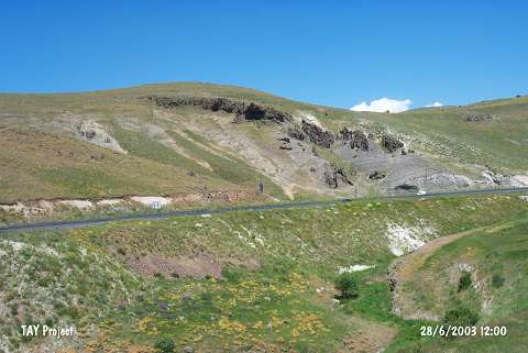
| It is located 1.5 km east of the Nenehatun Village of the Erzurum provincial centre. To immediate south passes by the Erzurum-Pasinler (Hasankale) motorway. The rock shelters are located on the rocks rising northward at 12th km of the motorway. It was explored during a survey covering the provinces of Erzincan; Erzurum and Kars by A. Ceylan of the Atatürk University in 2001; and documented as Hamamderesi Rock Chambers. The shelters were reported to be dating back to the Middle Age; and material of the Palaeolithic Age was uncovered; as well. |
| Location: |
| Structural Properties and formation : |
| Research History: |
| Findings: |