|
|
||||
|
|
||||
|
Inalti |
||||
|
For cave maps and drawings please click on the picture... |
For photographs please click on the photo... |
|||
|
 |
|||
|
Type: |
Cave | |||
|
Altitude: |
1160 m | |||
|
Depth: |
-24 m | |||
|
Length: |
625 m | |||
|
Region: |
Black Sea | |||
|
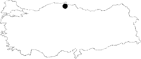
Province: |
Sinop | |||
|
District: |
Ayancik | |||
|
Village: |
Inalti | |||
|
|
||||
 |
||||
| Location: It lies next to the Inalti Village about 35 km far from the Ayancik District of Sinop. It can be reached from a dirt; but scenic road. The distance between the Inalti Village and the cave is around 400-450 m with a high incline. |
| Structural Properties and formation : It starts with a large and high entrance and maintains it up to 350-400 m. Being 3-6 m wide; and 5-25 high; it continues like a big tunnel. The first 350-400 m is adorned partly with big and small stalactites and travertines on the walls. The total length is 625 m; and the part after 400 m is full of sludge. |
| Research History: It was explored and mapped by ANMAK in 1991. |
| Findings: |