|
|
||||
|
|
||||
|
Gökçeali |
||||
|
For cave maps and drawings please click on the picture... |
For photographs please click on the photo... |
|||
|
 |
|||
|
Type: |
Horizontal Cave | |||
|
Altitude: |
60 m | |||
|
Depth: |
m | |||
|
Length: |
30 m | |||
|
Region: |
Marmara | |||
|
Province: |
Istanbul | |||
|
District: |
Çatalca | |||
|
Village: |
Gökçeali | |||
|
|
||||
 |
||||
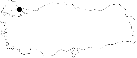
| Location: It lies within the boundaries of the Gökceali Military Zone; 7 km north to the Catalca District. The road around the military zone first leads to a pool; then to a small cafe. The entrance lies about 50 m right of the cafe. Permission is required from military forces for entrance. |
| Structural Properties and formation : It consists of two big galleries; and the bottom is covered with guano. |
| Research History: It was explored during the Eurasian Bridge '99 Project. |
| Findings: Numerous bats inhabit the cave: M. myotis/blythii and M. schreibersii. Also found are a limited number of M. capaccinii and R. euryale. |