|
|
||||
|
|
||||
|
Gavur |
||||
|
For cave maps and drawings please click on the picture... |
For photographs please click on the photo... |
|||
|
 |
|||
|
Type: |
Horizontal Cave | |||
|
Altitude: |
375 m | |||
|
Depth: |
m | |||
|
Length: |
280 m | |||
|
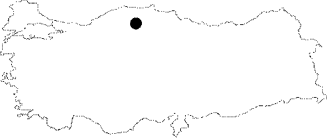
Region: |
Black Sea | |||
|
Province: |
Kastamonu | |||
|
District: |
Inebolu | |||
|
Village: |
Bayiralan | |||
|
|
||||
 |
||||
| It can be reached by about a 1.5 minute walk from the Bayiralan Village. It was formed within limestones. It was explored by MAD in May 1994; and mapped to the BCRA 3c standards. |
| Location: |
| Structural Properties and formation : |
| Research History: |
| Findings: |