|
|
||||
|
|
||||
|
Delikli |
||||
|
For cave maps and drawings please click on the picture... |
For photographs please click on the photo... |
|||
|
 |
|||
|
Type: |
Horizontal Cave | |||
|
Altitude: |
1020 m | |||
|
Depth: |
-15 m | |||
|
Length: |
222 m | |||
|
Region: |
Marmara | |||
|
Province: |
Bursa | |||
|
District: |
Inegöl | |||
|
Village: |
Elmaçayir | |||
|
|
||||
 |
||||
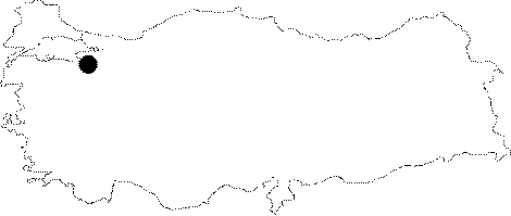
| Location: It lies 20 km southwest of Inegöl. It is located on the upper slope of the junction where the Ulupinar Creek; which flows in the canyon valley; divides into two branches; near the Elmacayiri Village to the east of Uludag. It is difficult to reach to the cave from Elmacayir as it is necessary to climb a steep; 170 m deep canyon. It is much practical to take the road from the Inayet Village; which runs up to the Alacam Fountains located to the south of the village. From there; the cave is reached by a half-an-hour walk on the pathway along the left bank of the Eskibicakci Creek. On return; it is much easier to get down to the Elmacayir Village via canyon. |
| Structural Properties and formation : It has three entrance openings facing the canyon of Eskibicakci Creek. Two close main entrances are like -1.5 and -4 m shafts; which both lead to the first formed; north-south directed main gallery. There is little dripstone formation. A second room is reached through a narrow gallery deviating from the main gallery. It is much younger and it is opened to the canyon by a window. It is adorned with stalactites and stalagmites. |
| Research History: It was explored and mapped by MTA; and published in 1997. |
| Findings: Bats were seen in the cave. |