|
|
||||
|
|
||||
|
Dedetepe 2 |
||||
|
For cave maps and drawings please click on the picture... |
For photographs please click on the photo... |
|||
|
 |
|||
|
Type: |
Horizontal Cave | |||
|
Altitude: |
650 m | |||
|
Depth: |
m | |||
|
Length: |
16 m | |||
|
Region: |
Marmara | |||
|
Province: |
Bursa | |||
|
District: |
Iznik | |||
|
Village: |
Çandarli | |||
|
|
||||
 |
||||
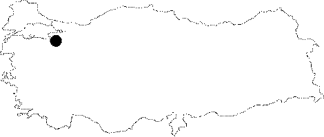
| Location: It is located on the western slope of the Dedecal Hill between Gürmüzlü and Candarli Villages. It can be reached by the Iznik-Elbeyli-Gürmüzlü-Candarli road. The smooth stabilized road reaching up to the Dedecal Hill from Iznik is 18 km. A 10 minute-walk through a pathway among dense forest leads to the cave. It lies 500 m south of the Dedetepe Cave. The village was named as Gürmüzlü in the map of the cave. |
| Structural Properties and formation : It was formed within the Cretaceous aged Bilecik limestones. It is a spring type of fossil cave. There is a thick deposit in the floor; and occasional driptone formations on the lateral walls. |
| Research History: It was explored and mapped by MTA; and published in 1997. |
| Findings: |