|
|
||||
|
|
||||
|
Damlatas |
||||
|
For cave maps and drawings please click on the picture... |
For photographs please click on the photo... |
|||
|
 |
|||
|
Type: |
Cave | |||
|
Altitude: |
1150 m | |||
|
Depth: |
-5 m | |||
|
Length: |
18 m | |||
|
Region: |
Mediterranean | |||
|
Province: |
Isparta | |||
|
District: |
Egirdir | |||
|
Village: |
Gökdere | |||
|
|
||||
 |
||||
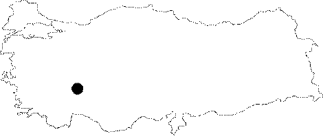
| It lies on the Gökdere-Eskiköy road; right above the ruins of Eskiköy. It was formed within the Jura-Cretaceous aged limestones. It is completely adorned with stalactites; stalagmites and columns. It is a dry cave. A family of grey-white coloured mice inhabit the cave. It was explored and mapped by MTA. |
| Location: |
| Structural Properties and formation : |
| Research History: |
| Findings: |