|
|
||||
|
|
||||
|
Çesme |
||||
|
For cave maps and drawings please click on the picture... |
For photographs please click on the photo... |
|||
|
 |
|||
|
Type: |
Horizontal Cave | |||
|
Altitude: |
1000 m | |||
|
Depth: |
m | |||
|
Length: |
66 m | |||
|
Region: |
Mediterranean | |||
|
Province: |
Mersin | |||
|
District: |
Tarsus | |||
|
Village: |
Sanlica | |||
|
|
||||
 |
||||
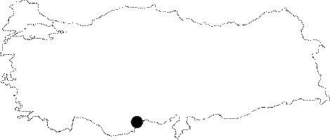
| The Sanlica (Fenk) Village is at a half an hour distance from Gulek. It was explored and mapped to the BCRA 3c standards by MAD in 1993. |
| Location: |
| Structural Properties and formation : |
| Research History: |
| Findings: |