|
|
||||
|
|
||||
|
Çatirik |
||||
|
For cave maps and drawings please click on the picture... |
For photographs please click on the photo... |
|||
|
 |
|||
|
Type: |
Vertical Cave | |||
|
Altitude: |
1570 m | |||
|
Depth: |
-88 m | |||
|
Length: |
20 m | |||
|
Region: |
Mediterranean | |||
|
Province: |
Mersin | |||
|
District: |
Silifke | |||
|
Village: |
Sariaydin | |||
|
|
||||
 |
||||
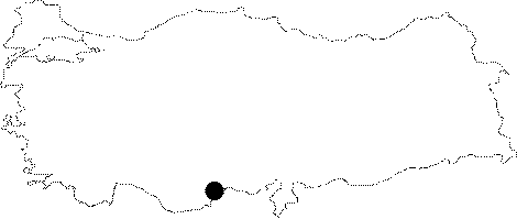
| Location: The cave is by the entrance of a canyon; towards the Erenler Area; by Aksifat River; nearly 2-3 kms far from the from the Sariaydin Village at Mersin; Silifke. |
| Structural Properties and formation : The Catirik and Kaleburun Caves are tectonic cracks located on the same fault; which is obvious in their maps. In fact; both ends of the two caves do not have an end; and continue along the fault. However; it is not possible to proceed further as it gets ever narrower (15-20 cm). The entrance of the Catirik Cave is very narrow; and it is like a quadrangle with two parallel sides being 15 cm and 35 cm; and other sides being 64 cm. The ceiling of the roof couldn't have been seen due to its restricted width. The width of the cave starts to get narrower after -33 m. At this narrow section of 22 cm; the walls are adorned with coral decorations; and passage is very difficult. Later on; this section suddenly reaches to a larger gallery. It is a dangerous cave since it is difficult to belay safely. |
| Research History: It was explored by BUMAK in 1986; and mapped to the 4c standard. |
| Findings: |