|
|
||||
|
|
||||
|
Çalvo |
||||
|
For cave maps and drawings please click on the picture... |
For photographs please click on the photo... |
|||
|
 |
|||
|
Type: |
Horizontal Cave | |||
|
Altitude: |
1080 m | |||
|
Depth: |
-4 m | |||
|
Length: |
16 m | |||
|
Region: |
Marmara | |||
|
Province: |
Bilecik | |||
|
District: |
Pazaryeri | |||
|
Village: |
Saridayi | |||
|
|
||||
 |
||||
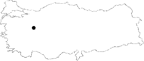
| It lies 3 km north of the Saridayi Village. A 5 km stabilized road deviating from the Aksutekke Village on the Inegöl-Bozüyük motorway leads to the Saridayi Village. The cave is near the village. It was developed on a pronounced fault line within marbles overlaying the Permian aged schists. It consists of a single gallery. The roof height ranges from 1 to 2 m; and the inclining floor is covered with a thick layer of debris. It is dry throughout the year. It was explored and mapped by MTA; and published in 1997. |
| Location: |
| Structural Properties and formation : |
| Research History: |
| Findings: |