|
|
||||
|
|
||||
|
Civ |
||||
|
For cave maps and drawings please click on the picture... |
For photographs please click on the photo... |
|||
|
 |
|||
|
Type: |
Vertical Cave | |||
|
Altitude: |
2000 m | |||
|
Depth: |
-238 m | |||
|
Length: |
m | |||
|
Region: |
Mediterranean | |||
|
Province: |
Isparta | |||
|
District: |
Aksu | |||
|
Village: |
||||
|
|
||||
 |
||||
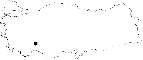
| Location: It is close to the Cayir Plateau on the Dedegöl Mountains. The nearest water resource is 8 km away. |
| Structural Properties and formation : It has very rich decorations. The catwalk at the end of the first descent which can be occluded by snow can be bypassed by descending with a rope. A total of 15 more descents runs into a flowing water and here the cave ends up with a siphon. The walls of the most of the descents are decorated with orange flowstones; and mainly they end up with crystal clear lakes. |
| Research History: It was explored and mapped by British cavers from the Sheffield University in 1989; and published in 1991. |
| Findings: |