|
|
||||
|
|
||||
|
Cilga |
||||
|
For cave maps and drawings please click on the picture... |
For photographs please click on the photo... |
|||
|
 |
|||
|
Type: |
Horizontal Cave | |||
|
Altitude: |
150 m | |||
|
Depth: |
m | |||
|
Length: |
40 m | |||
|
Region: |
Aegean | |||
|
Province: |
Izmir | |||
|
District: |
Seferihisar | |||
|
Village: |
Cilga | |||
|
|
||||
 |
||||
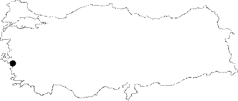
| Location: The cave; only accessible from the sea; can be reached by renting a fishing boat at Sigacik; and going to the Cilga Bay at the western end of the Sigacik Gulf. After landing; a 45-minute walk leads to the cave. |
| Structural Properties and formation : It was formed within limestones; and it is adorned with plenty of stalactites; stalagmites and columns. |
| Research History: It was discovered by H. Erkanal in 1993. It was explored by MAD in 1994 and mapped to the BCRA 3c standard. |
| Findings: Enormous number of bats were seen. The Cilga Cave; which has an archaeological value; had been used as cult from the 4th century; particularly in the 6th century. It was dedicated to Hecate; the Goddess of the Underworld. |