|
|
||||
|
|
||||
|
Cennet |
||||
|
For cave maps and drawings please click on the picture... |
For photographs please click on the photo... |
|||
|
 |
|||
|
Type: |
Horizontal Cave | |||
|
Altitude: |
150 m | |||
|
Depth: |
m | |||
|
Length: |
500 m | |||
|
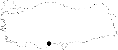
Region: |
Mediterranean | |||
|
Province: |
Mersin | |||
|
District: |
Silifke | |||
|
Village: |
Narlikuyu | |||
|
|
||||
 |
||||
| Özbek 1992 ölçüm 220; -165 |
| Location: On a big pile of debris and approximately at 60 m altitude on the western end of the elliptical Cennet pit lies the remains of an ancient Byzantium church. At this point; the cave starts and continues westward. It is very close to the Cehennem Cave. It is a show cave. |
| Structural Properties and formation : It is a pit which was formed by the depression of the roof; which had been corroded by an underground creek; within the Miocenic calcareous deposits. Elevated 150 m from the sea level; the pit is descended by a pathway with stairs from the Roman Period. At the deepest point of the cave; a small part of the underground water looks like siphon; and sometimes it is flooded depending on the season. |
| Research History: It was first explored by T. Aygen. |
| Findings: There lies remains of a Byzantium church on the western end. A few bats (Myotis nattereri; Eptesicus bottae) were seen [Benda-Horacek 1998:274; 285]. |