|
|
||||
|
|
||||
|
Büyük Obruk |
||||
|
For cave maps and drawings please click on the picture... |
For photographs please click on the photo... |
|||
|
 |
|||
|
Type: |
Vertical Cave | |||
|
Altitude: |
m | |||
|
Depth: |
-190 m | |||
|
Length: |
m | |||
|
Region: |
Central Anatolia | |||
|
Province: |
Konya | |||
|
District: |
Güneysinir | |||
|
Village: |
Karasinir | |||
|
|
||||
 |
||||
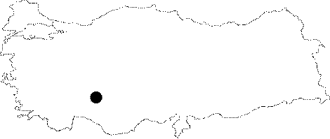
| Location: It lies 1.5 km northwest of the Karasinir Town; which is located at 10th km of the road leading to the Göksu Hydroelectric Central from 62nd km of the Konya-Karasinir road. |
| Structural Properties and formation : It is a cavity in the form of a smooth walled gallery; submerging for 50 m long and 1.3-1.5 m wide under the ground along with a fault line in the south southwest-north northeast direction on the northeastern part of Büyükdag. The bottom is covered with blocks and pebbles. It is likely to have a depression in the cave. |
| Research History: It was explored in 1978 by the Speleo Club des Causses and Speleo Club de Lodeve. |
| Findings: |