|
|
||||
|
|
||||
|
Beyköy Düdeni |
||||
|
For cave maps and drawings please click on the picture... |
For photographs please click on the photo... |
|||
|
 |
|||
|
Type: |
Vertical Cave | |||
|
Altitude: |
460 m | |||
|
Depth: |
-60 m | |||
|
Length: |
99 m | |||
|
Region: |
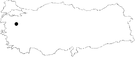
Marmara | |||
|
Province: |
Balikesir | |||
|
District: |
Kepsut | |||
|
Village: |
Beyköy | |||
|
|
||||
 |
||||
| Location: It is located on the Kobartkasi Ridge; 2 km east of Beyköy. The skirts of the ridge where the cave is located can be reached from a stabilized road; deviating at 7th km of the Kepsut-Dursunbey motorway. Then; a half and hour climbing among short macchias leads to the cave. |
| Structural Properties and formation : Until recently; there were lead mines in the cave and its vicinity. It is a fossil cave which halted its geological development. There are digged galleries inside; therefore figures of the first formation have all been disappeared. The first entrance is a -15 m shaft. |
| Research History: It was explored and mapped by MTA; and published in 1997. |
| Findings: A few bats were seen in the final zone. |