|
|
||||
|
|
||||
|
Besmeseler Yarasa |
||||
|
For cave maps and drawings please click on the picture... |
For photographs please click on the photo... |
|||
|
 |
|||
|
Type: |
Vertical Cave | |||
|
Altitude: |
m | |||
|
Depth: |
-39 m | |||
|
Length: |
60 m | |||
|
Region: |
Marmara | |||
|
Province: |
Istanbul | |||
|
District: |
Merkez | |||
|
Village: |
Gümüspinar | |||
|
|
||||
 |
||||
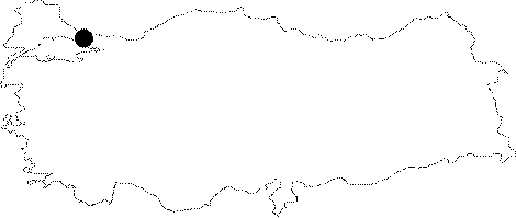
| Location: Five kilometers west to the Akalan Village of Catalca lies the Besmeler Village. The cave is located in a forestry 1 km further towards Saray. While coming from Gürpinar; a turn should be made to right to a dirt road leading to the sand quarry. After 100 m; a turn should be made to left on the line of the utility poles. It may not be easy to reach to the depression as the area is occupied by trees. |
| Structural Properties and formation : It was formed within a depression of calcareous structure. The cave is reached from a 4 m mouth through a 25 m descent. It elongates northeastward by an approximately 20 m path which is covered by rocks and stones; and ends up in a somewhat large hall and a soil sinkhole. The depth of the cave is -39 m at this point. It is the deepest known cave of Istanbul region. |
| Research History: It was explored by BUMAK in 1993; and mapped to the 3c standard. |
| Findings: Considerable amount of guano on the floor gives an idea about the excessive population of bats inhabiting the cave. |