|
|
||||
|
|
||||
|
Beldibi - Siginak Yeri |
||||
|
For cave maps and drawings please click on the picture... |
For photographs please click on the photo... |
|||
|
 |
|||
|
Type: |
Cave | |||
|
Altitude: |
m | |||
|
Depth: |
m | |||
|
Length: |
m | |||
|
Region: |
Mediterranean | |||
|
Province: |
Antalya | |||
|
District: |
Merkez | |||
|
Village: |
Oba | |||
|
|
||||
 |
||||
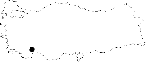
| Location: It is a rock shelter located right after the exit of the Camdag Tunnel around 40th km of the coastal Antalya-Kemer motorway. It is located at Oba Köyü Mevkii. |
| Structural Properties and formation : It is a shelter-like cave with a 25 m altitude from the sea level. As it was greatly damaged by natural destruction; the filled layers inside the cave had been drained away; swept by rainwater and wind. |
| Research History: It was declared as Grade 1 archaeological protection zone in 1985. |
| Findings: Six layers were found; all consisting of Mesolithic cultures. The excavations uncovered flintstone tools belonging to the Upper Palaeolithic and Mesolithic eras. Also; there are schematised drawings of human; chamois and geer on the walls of the under rock shelter. It is a protection area open to touristic visits. |