|
|
||||
|
|
||||
|
Belbasi |
||||
|
For cave maps and drawings please click on the picture... |
For photographs please click on the photo... |
|||
|
 |
|||
|
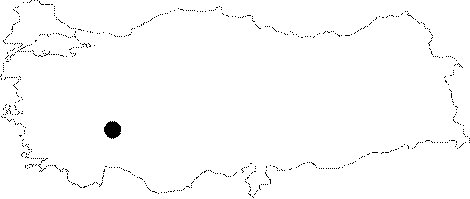
Type: |
Vertical Cave | |||
|
Altitude: |
1400 m | |||
|
Depth: |
-35 m | |||
|
Length: |
59 m | |||
|
Region: |
Mediterranean | |||
|
Province: |
Isparta | |||
|
District: |
Egirdir | |||
|
Village: |
Yuvali | |||
|
|
||||
 |
||||
| It lies on a threshold between the Alcidagi Hill (1585 m) and the Dulup Mountain (2046 m) to the north of the Yuvali Village. It is at a 8-10 m walking distance from the village on the road connecting the Yuvali Village to the Akdogan Village. It was formed vertically along a pronounced fault within the Mesozoic aged limestones. The bottom is covered with debris. The side walls are adorned with dripstones. Bats were found in the cave. It was explored and mapped MTA. |
| Location: |
| Structural Properties and formation : |
| Research History: |
| Findings: |