|
|
||||
|
|
||||
|
Bayram Yuvasi Düdeni |
||||
|
For cave maps and drawings please click on the picture... |
For photographs please click on the photo... |
|||
|
 |
|||
|
Type: |
Vertical Cave | |||
|
Altitude: |
970 m | |||
|
Depth: |
-31 m | |||
|
Length: |
33 m | |||
|
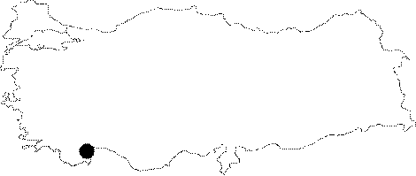
Region: |
Mediterranean | |||
|
Province: |
Antalya | |||
|
District: |
Ibradi | |||
|
Village: |
||||
|
|
||||
 |
||||
| It takes only 3 minutes to reach to the cave from the final houses to the southwest of Ibradi. It was explored by French cavers; and mapped to the 2b standards by P. Pietra in 1980. It was also mapped to the 2c standards by C. Chabert. |
| Location: |
| Structural Properties and formation : |
| Research History: |
| Findings: |