|
|
||||
|
|
||||
|
Ayiini |
||||
|
For cave maps and drawings please click on the picture... |
For photographs please click on the photo... |
|||
|
 |
|||
|
Type: |
Horizontal Cave | |||
|
Altitude: |
310 m | |||
|
Depth: |
-35 m | |||
|
Length: |
137 m | |||
|
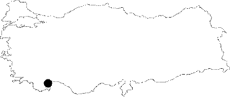
Region: |
Mediterranean | |||
|
Province: |
Antalya | |||
|
District: |
Kumluca | |||
|
Village: |
Çavus | |||
|
|
||||
 |
||||
| It is located on a steep slope of the Tüfekkumu Hill facing northwest on the upper bank of the Kiste Creek spilling into the Cavus (Adrasan) Bay. It can be reached by a 45 minute walk from the Bahceler Quarter. It was formed on a very fractured weak zone within the Cretaceous aged limestones. It has a wide volume; and the bottom is covered by blocks of rocks. Through the end of cave was formed a chimney as a result of roof collapse. A narrow corridor to the west of the entrance hall leads into a side branch fully adorned with travertines. There is a 25 m deep shaft at the end of this branch. It is a dry cave. Plenty of guano was observed; indicating that it has been inhabited by bats in winter. It was explored by MTA. |
| Location: |
| Structural Properties and formation : |
| Research History: |
| Findings: |