|
|
||||
|
|
||||
|
Avdancik |
||||
|
For cave maps and drawings please click on the picture... |
For photographs please click on the photo... |
|||
|
 |
|||
|
Type: |
Horizontal Cave | |||
|
Altitude: |
350 m | |||
|
Depth: |
-13 m | |||
|
Length: |
162 m | |||
|
Region: |
Marmara | |||
|
Province: |
Bursa | |||
|
District: |
Osmangazi | |||
|
Village: |
Avdancik | |||
|
|
||||
 |
||||
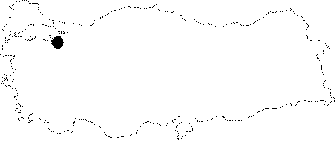
| Location: It is located on the western side of the Ballikaya Hill; north to the Aydancik Village. Through a stabilized road deviating from the Selcukgazi Village junction; which is right on the half way of the Bursa-Gemlik motorway; it is possible to reach to the Inbayir Hill; and from there; a half-an-hour walk leads to the cave located on the left bank of the Ballik Creek. |
| Structural Properties and formation : It was formed on a pronounced fault line within the Jura Lower Cretaceous limestones. The entrance of the cave; which is a fossil sinkhole; is like a -11 m deep shaft. The height varies between 10 and 15 m. There is no or little dripstones inside the cave. |
| Research History: It was explored and mapped by MTA; and published in 1997. |
| Findings: The cave; which is located in a heavily forested area; is inhabited by limited number of bats; millipedes and black colored molluscs in the entrance zone. |