|
|
||||
|
|
||||
|
Aslanli / Yaren |
||||
|
For cave maps and drawings please click on the picture... |
For photographs please click on the photo... |
|||
|
 |
|||
|
Type: |
Cave | |||
|
Altitude: |
270 m | |||
|
Depth: |
-36 m | |||
|
Length: |
110 m | |||
|
Region: |
Aegean | |||
|
Province: |
Aydin | |||
|
District: |
Kusadasi | |||
|
Village: |
Kirazli | |||
|
|
||||
 |
||||
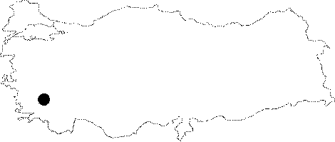
| Location: It is located at a half-and-hour walking distance at Derebogazi Mevkii; at 3rd km of the Kirazli-Kusadasi motorway. |
| Structural Properties and formation : It was formed within the Mesosoic dolomitic marbles and on a somewhat large fault. Following a 6 m steep descent; the cave enlarges with a 26 degrees slope westward along with an east-west directed large fault and the floor gets the appearance of an inclining hall. The bottom of the hall is covered with muddy ground and rocky blocks fallen from the ceiling. It is adorned with stalactites; stalagmites; and curtains in the walls and drapery travertines. It is called "Aslanli" as one of the stalagmites looks like a seated lion. |
| Research History: It was explored and mapped by MTA. It takes place in the registered archaeological sites list prepared by Ministry of Culture and Tourism. |
| Findings: A big colony of bats and millipedes inhabit the cave. |