|
|
||||
|
|
||||
|
Asarini |
||||
|
For cave maps and drawings please click on the picture... |
For photographs please click on the photo... |
|||
|
 |
|||
|
Type: |
Horizontal Cave | |||
|
Altitude: |
1180 m | |||
|
Depth: |
-13.5 m | |||
|
Length: |
162 m | |||
|
Region: |
Central Anatolia | |||
|
Province: |
Konya | |||
|
District: |
Beysehir | |||
|
Village: |
Kurucaova | |||
|
|
||||
 |
||||
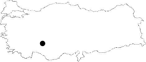
| Location: It lies to the west of the Beysehir Lake in the Kurucaova Town; 64 km away from Beysehir. |
| Structural Properties and formation : It was formed within the Cretaceous limestones. Any kind of cave decoration can be found inside the cave. It is a horizontally developed fossil cave and; through the end of the cave; there is a small lake. |
| Research History: It was first explored by Italians in 1970. It was re-explored and mapped by MTA in 1993. |
| Findings: Cave flies and grasshoppers were seen in the entrance zone and bats in the middle zone. |