|
|
||||
|
|
||||
|
Altinbesik |
||||
|
For cave maps and drawings please click on the picture... |
For photographs please click on the photo... |
|||
|
 |
|||
|
Type: |
Horizontal Cave | |||
|
Altitude: |
510 m | |||
|
Depth: |
+101 m | |||
|
Length: |
4500 m | |||
|
Region: |
Mediterranean | |||
|
Province: |
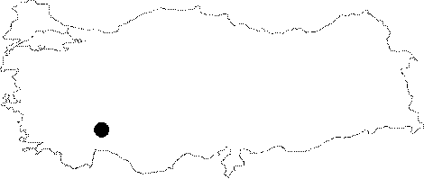
Antalya | |||
|
District: |
Akseki | |||
|
Village: |
Ürünlü | |||
|
|
||||
 |
||||
| Location: It is located near the Urunlu Village; 7 km away from the Ibradi settlement of Akseki District of Antalya Province. The roads are paved with asphalt until Ibradi whereas the one between Ibradi and Urunlü is stabilized. The cave is reached through a 5 km dirt road from the village running toward the Manavgat Creek. It is also called "Düdensuyu". |
| Structural Properties and formation : The Altinbesik Cave is located within the second geologic period (Cretaceous) limestones. It lies at the final end of a very long and large subterranean system. This system; which draws the waters of the Kizilova; Kembos and Söbücealan Plains and sinkholes located on the edge borders of these plains; comes to an end under the Oruc Düdeni Cave; at the Altinbesik Cave. The Altinbesik Cave drains the water from Büyükdüden; Oruc Düdeni and Feyzullahin Düdeni out to the Manavgat River. It starts with a 125 m long lake from its entrance; and its depth reaches up to 15 m at some places. In the middle of the lake; there is a bridge formed by a natural rocky block. At the end of the lake; there is a travertine covering the entire hall with a height of 44 m. In the cave; which then divides into 3 branches; the active branch has been explored until a hole of 8 m. The cave is entirely covered by travertines and clefts except the fossil branch. It can be visited only in summer and fall. During spring and winter; there occurs huge amount of water drainages in the cave. |
| Research History: It was discovered by T. Aygen in 1966 during the exploration and investigation studies for the Oymapinar Dam carried out in this region. The first exploration was carried out by a team of eleven people including three British; five French and three Turkish researchers in August 1966. The second important exploration was carried out by a team of fourteen people; including four Turkish; of two are journalists; and ten French people; who camped at the entrance of the cave for one week and explored the cave; which was 1600 m long; thoroughly. The French investigators included the chairman and members of the Paris Speleology Club and students of the Paris Orsay University. Later on; it was explored and mapped by G.E. Schmitt in 1979. Furthermore; the first and third siphons were dived in a joint excursion conducted by Czechoslovak and British groups in 1989; but no bright outcomes were obtained. |
| Findings: |