|
|
||||
|
|
||||
|
Alabelen |
||||
|
For cave maps and drawings please click on the picture... |
For photographs please click on the photo... |
|||
|
 |
|||
|
Type: |
Vertical Cave | |||
|
Altitude: |
535 m | |||
|
Depth: |
-32 m | |||
|
Length: |
41 m | |||
|
Region: |
Mediterranean | |||
|
Province: |
Antalya | |||
|
District: |
Kas | |||
|
Village: |
Belenli | |||
|
|
||||
 |
||||
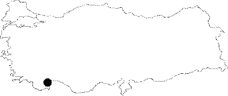
| It is located on a slope of the Yassikaklik Hill above the Belenli Village. It was formed within the Eocene aged chalky limestones. The side walls of the cave are adorned with dripstone decorations. The bottom is filled with blocks of rock and debris. It is a dry cave. It was explored and mapped by MTA. |
| Location: |
| Structural Properties and formation : |
| Research History: |
| Findings: |