|
|
||||
|
|
||||
|
Ahmetler Köyü |
||||
|
For cave maps and drawings please click on the picture... |
For photographs please click on the photo... |
|||
|
 |
|||
|
Type: |
Horizontal Cave | |||
|
Altitude: |
670 m | |||
|
Depth: |
-19 m | |||
|
Length: |
142 m | |||
|
Region: |
Mediterranean | |||
|
Province: |
Antalya | |||
|
District: |
Manavgat | |||
|
Village: |
Ahmetler | |||
|
|
||||
 |
||||
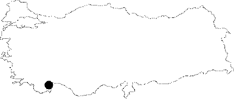
| It is located in the Ahmetler Village of the Manavgat District and used by village people. It was explored and mapped by C. Chabert in 1978 to the BCRA 4b standards. |
| Location: |
| Structural Properties and formation : |
| Research History: |
| Findings: |